Border Riding by Jo Reid
published by Stout Stoat Press
This is not a review, it is a “look at”. The reason for this is that this is really designed for a group, and I have only played it on my own.
TL:DR – I enjoyed it
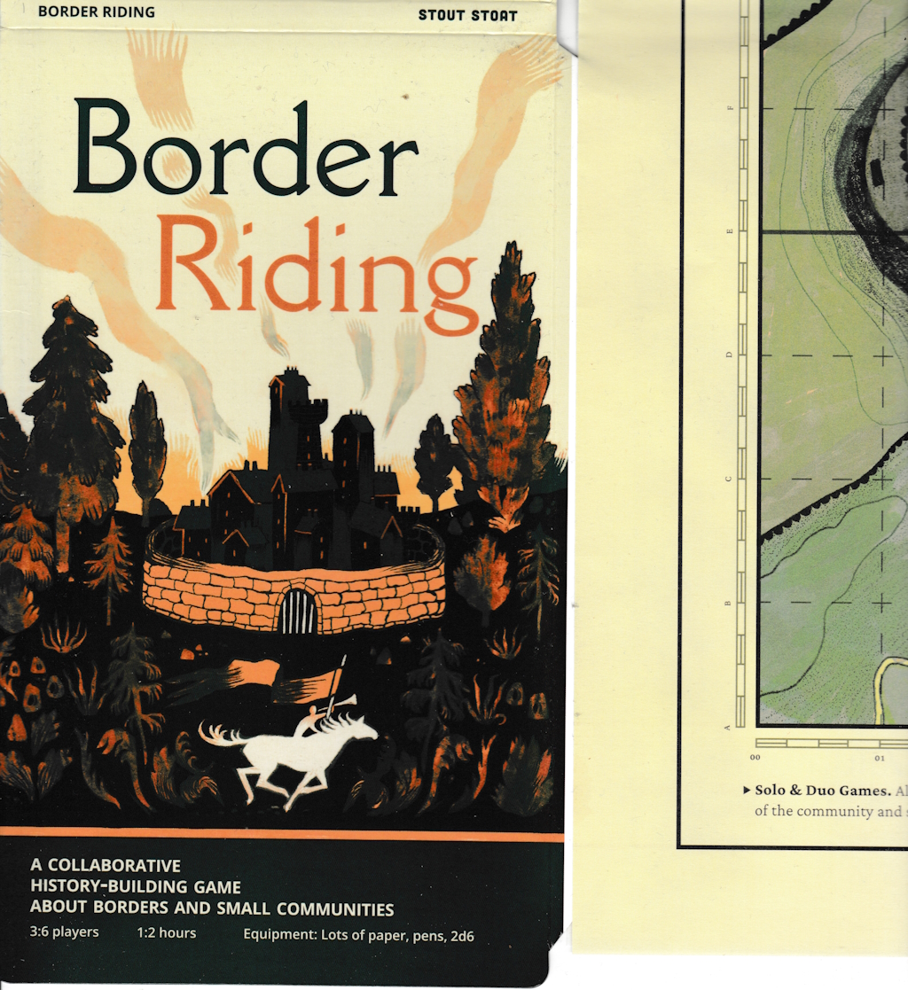
Map/Game cover and a glimpse of the unfolded map
I have never played any map games before. I have drawn plenty for RPGs, and even come up with histories and events, but they tended to be for larger national entities. This game in the form of a traditional folded map is more concerned with a smaller community area, and the closest I got to the feel of this from other
games I have played was playing “King of Dragon Pass”. It is also available in PDF form, reformatted for printing normally.
The concept, which might take it away from a game for some, and move it to the category of “pastime” is to build a narrative and history around roles taken by the players, the geographical and social features of the area, the events of years and those outside to the region.
The inspiring source material is a custom of the Scottish Borders, the “Common Riding”, where citizens of a town would ride the border, defining it. There are variations of the ceremony depending on the rown, and can feature elaborate routines of waving a large standard round at various heights as the standard bearer kneels and stands and displays the standard to all.
I mention the standard in particular, not just because the person leading the game in a round is “The Standard Bearer” but one-time during my 17th Centurey re-enactment career, I was a guard for the regimental standard bearer during the battle and that standard bearer, from the Borders, started doing the moves and, unused to people near him, whacked me in the guts At least, I assume it was an accident.
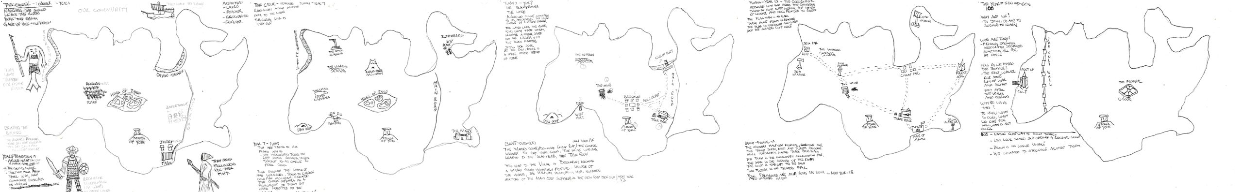
Starting map, next three turns, and final map
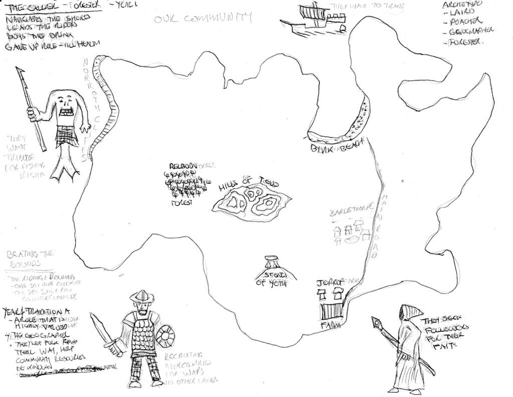
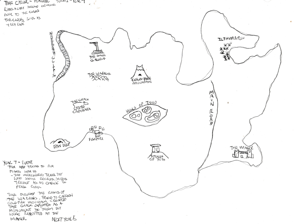
starting map
The map starts with a random, contiunous border. This border can be any, land or water, and onto that each player draws a geographical and social feature, e.g. a river and a windmill. There are also outsiders (Them). I can’t see any suggestion on how many, but I set one each. I imagine that a group could change the number and nature of the outsiders as they interpret the events.
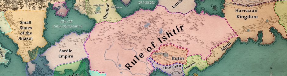
My concept was an island, surrounded by the mainland of a larger mainland, like Arran or Bute. Its outsiders are fishfolk who think land folk should pay them for fish, traders who arrive by ship, mercenaries who seek to recruit and a proslytising religion.
Obviously it is set up for 3 to 6 players, I found it not obvious what the accommodation was for solo players, though it is visible in the cover/map picture above as it is written under the bottom left of the map. The answer is “assume the role and viewpoint“. Given that, for solo/duo players it might be worthwhile getting a story prompt tool, like story dice, to help out with imagination.
second turn map – year 7
With a group, you are going to want to have people who can work together, it might be awkward with one or more dominant personalities or folk who can’t bounce off each other.
A new Standard Bearer is elected for each turn, not repeating until everyone has had a turn In each turn, an Event is randomly generated, in one of a variety of categories, from innocous to unfortunate, and the group discuss how this affectes things, thoug that turn’s Standard bearer is the arbiter of the debate.
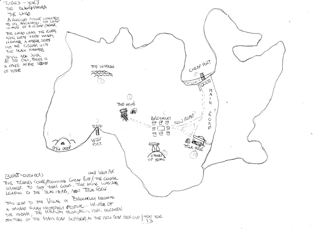
The third turn – year 8
I found the guidance about the transferring from one turn to the next unclear. The rules say you copy four of the existing geographical or social features over, but I didn’t know how new geographical and social features got generated, so I asked and they got directed to the relevant passage about them being generated by the events phase.
The Standard Bearer confirms the permanent consequences of this event, and draws the relevant changes onto the current map.
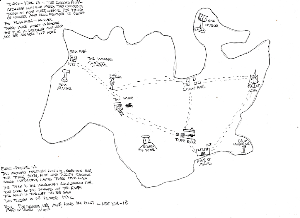
the fourth turn – year 13
This means that the chat about what the event means for the region, the inhabitants and the outsiders is important.However the game says that it can take 1- 2 hours to play, as an average game will have about 18 turns, that means each turn will be between 3 to six and a bit minutes.
I suggest thin paper you can easily see through to make it easier to copy outline and map to the new map.
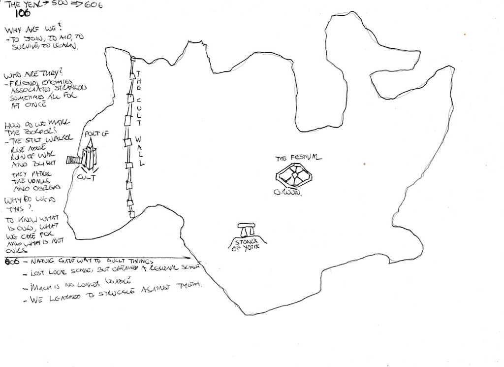
The last two years of play, Year 106 and Year 606
This means that, as well as a changing story, influenced by events, you
look back at a changing geography (even the border outline, unless you are amazing at copying) and what features the “community” considers important, until you follow through about 5 or 6 generations and you leap forward to look back at it all.
I know you get some folk using things like this for campaign backgrounds, maybe not to the extent of “Traveller”, and I am not sure every play through would be useful for that, but some of them could be used to flesh out small areas for an RPG.
As a story game it was fun, and it’s a pity that I missed out on the cooperative experience and other peoples’ ideas, , because this has been a new and engaging thing to do, and bouncing ideas off each other would make it even better.
Sounds like a blast. Makes me want to re-read George MacDonald Fraser’s book on the border reivers.
“The Steel Bonnets” is a good read, nice and humorous in its history